Ready? There are are about 164 pictures on this post. (I took 400+). SO I hiked the Chilkoot Trail!
When the stampeders were on their way to the Klondike Gold Fields in the Yukon Territory, they had to sail up the Inside Passage from Seattle, to get to either Skagway, or Dyea (about 10 miles to the west of Skagway). From Dyea, they could hike the Chilkoot Trail, and from Skagway, the White Pass Trail. These trails led 33 miles inland to Lake Bennett. These mountain passes are two of very few passes that allow access into the interior from the sea.
Lake Bennett, where the trail ends, is one of the lakes that makes up the headwaters of the Yukon River that flows north right past the gold fields. About 40,000 people, between 1897 and 1898 hiked these trails to get themselves and their supplies northward. At Lake Bennett, they would pack their supplies up on small hand-constructed boats and set out for the final leg of the journey, 560 miles up the Yukon River.
I'm giving you this background information because it gives so much more meaning to this trail. Also keep in mind that at the summit, the Canadian North West Mounted Police were requiring that every stampeder who came into Canadian territory (where the gold fields are) have at least one year's worth of supplies and food (to avoid starvation). That makes for about 2,000 pounds, or one ton of goods.
ALSO keep in mind that the gold rush started in late 1897 - meaning that in their determination to reach the Klondike first, these men were traveling in the middle of winter. Freezing temperatures, and up to 50 feet of snow. More than half of the original 100,000 who set out for the gold fields turned back; the journey was too difficult.
So I won't make you read much more, but as you are looking through these pictures, imagine it FULL of men and their supplies. Each had to carry at least 50 - 100 lbs on his back each trip, and make about 40 to 50 trips to get all of their supplies to Lake Bennet.
Fortunately, all I had to carry was a 32 - 37 lb backpack the whole time, and the weather was pretty great for the most part.
So here, check it out!
Brown bear prints! They were HUGE! (compare to the boot print to the right)
Ruins of a logging operation from the 1940s - 1950s.
Some of the trail was over water... and we had to walk across these planks! Fortunately, none of us fell.
Saw salmon swimming upstream for the first time in my life! Really amazing. Sad thing is, these fish are dying a slow and painful death, rotting from the inside out. They are salt water salmon, and as they swim into fresh water streams, their bodies can't process it for oxygen. Poor things. Bears like 'em, though!
The tree where we ate lunch at Finnegan's Point.
Glacier-fed waterfall...
More salmon swimming to their deaths upstream.
Really freaky suspension bridge at Canyon City!
Ooohh this is a cool one! These are the ruins at Canyon City. This steam powered locomotive engine was manufactured in 1886! It was brought up here to power a tram line in late 1898. For 7 cents per pound, you could load your supplies into a car, and this engine would power it over the summit to the other side. Made for a much faster, and easier journey for those who had the money! For most of the trail we could see the line where it fell on the ground.
Haha, I don't think she knows I have a blog. Good thing.
Parts of the trail weren't very friendly!
The "Fly Agaric" is a poisonous mushroom, it's a hallucinogenic, but can lead to DEATH in susceptible adults and small children. (That's what the brochure said... "DEATH!")
Scary 300 - 400 foot drop off... I could feel the cold wind blowing up from the valley!
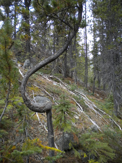
We encountered lots of unique trees on the way. This one baffles me.
These dogs are adopted... retired sled dogs from the Yukon Territory. They had the most beautiful eyes! We saw these dogs on our way up to the tallus field (tallus = essentially just large rocks).

AWESOME GLACIER I COULD NOT STOP TAKING PICTURES OF! Also near the tallus field north of Sheep Camp.
"Long Hill." You can guess how it got its name. It's a longgggggg slope all the way from Sheep Camp to the Scales before the summit. NOT FUN.
Another picture of the glacier, I swear it looked completely different every two minutes.
We stayed at Sheep Camp for two nights. The first day we had there we hiked up Long Hill to the tallus field, and smashed rocks all day as part of a service project. (Last winter there was a rock slide that covered a portion of the trail; for several days the trail crew had been working to restore an easier trail. Jacki and I helped by breaking rocks to fill this particular stretch of trail. It was actually kind of fun! And very rewarding; who knows how long hikers will use this trail in the future? We're a part of preserving the historic Chilkoot Trail!)
Jacki said I could have a career in rock breaking. But I wasn't the only one who enjoyed it this much! Promise. Some kids wanted to skip lunch so they could keep breaking rocks. We did have to clarify to several people that we weren't prisoners, though...
Later that day we did some "brushing." Essentially clearing the trail so it would be easier for hikers to see. It's important to maintain good visibility on the trail considering there might be a 350 - 1,500 lb bear around the corner.
Yikes, I didn't know they could get that big til I looked it up just now! Thank goodness we didn't see any on the trail!! I think they tend to stay away from groups of 11 noisy kids, anyway.
Oh, that glacier again. I can't wrap my head around these things.
Our portion of the trail upon completion!
This is the morning we set out for the summit.
Looking back :)
Getting a little higher!
These things were adorable! And didn't mind us humans at all. They were basically running around our feet.
Yuck!
Reward: Amazing view of the mountain range (AND glaciers!!! See them in the top right?)
That sign tells us about the "Scales." Where men would bring their supplies to be weighed and taxed by the North West Mounted Police. Then up the hill they go!
The "Golden Stair" during the Gold Rush...
The "Golden Stair" today... there are people climbing it in this picture. The fact that you can't see them tells you a little about the scale of this thing!
It's a 37 degree slope up the side of a mountain. Needless to say I was a little more than intimidated.
Artifacts left from over 100 years ago! People dropped lots of things here because they didn't want to carry it any further, or didn't want to pay the tax on it.
Usually this area is extremely foggy; we got lucky with a clear day. These orange markers help hikers find their way in the snow and fog.
One last view of those glaciers!! SO AMAZING!!! Earth at work.
Yep, that's it. Looked like a lot more than 37 degrees to me... maybe more like 90! It wasn't actually as hard as long hill. It was so steep we were moving pretty slow, and on our hands and knees.
I think I just sat here wide-eyed for a while. I just climbed a mountain. I'm SITTING, on a mountain. In Alaska. (at about 3,800 feet above sea level here! :)
The snowy parts were the worse. Those grooves sometimes turned to ice, and made for pretty slow-going.
And then... Canada! Or Narnia. I think I took 15 pictures of this view alone; everytime I looked up at it I would think, "WHOA!" and have to take another picture.
I couldn't get it through my head that I was looking at this. Look at those lakes!
Warming shelter at the summit, for people to rest before continuing another 4 miles to Happy Camp.
Then, more snow.
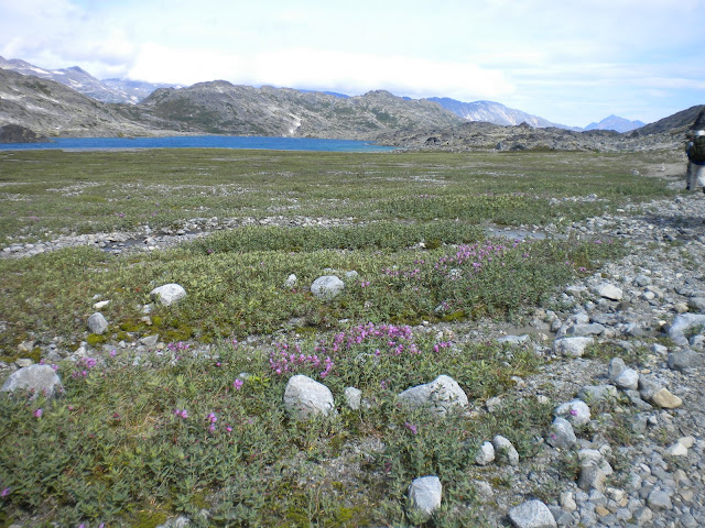
Rocky landscape around the lakes. The Canadian side was a lot different than the American side. On the American side, everything is pretty lush, a temperate rainforest. On this side, it was mostly dirt and rocks.
Beautiful beautiful beautiful!
Took a break to lay on the sand. Quite comfortable after 5 or 6 hours of hiking.
There was a lot going on - I've never been to environment like this, everything was a surprise! I didn't know they made water that blue this far north!
Mmhmm, another glacier. Slowly sliding down the mountain....
Trail markers like these helped us figure out where they trail was. It wasn't so obvious in some spots.
We were only allowed to cross these one at a time....
This is Deep Lake - and really what I expected when I came to Alaska!
Ruins from the gold rush! Over 7,000 boats were built in the Spring of 1898 to navigate the Yukon River.
The world is a big place. Never really knew how big, til I got to Alaska. I also began to realize how small and insignificant we are in the grand scheme of things... not just physically in this landscape, but in history and time. Crazy!
Another confused tree...
Lindeman City! Last stop before Lake Bennett and the train ride home!
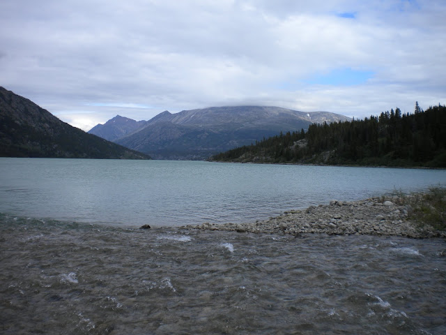
Lake Lindeman was beaauuuttiiffulllllllllll!
That's a little Canadian flag. Tried to get it in there artistically, but you get the idea.
There's a cloud on that mountain! One of my favorite pictures from the trip. Or ever.
I think if I wasn't surrounded people I would have started jumping and screaming... this experience was incredibly surreal and overwhelming. I had hiked through mountains, but they still hardly made sense to me.
Don't have an explanation for this one, sorry! It's just really small!
Lake Bennett!! THE END!
Church built in 1899 for stampeders.... still stands today! Around these lakes, and in these camp grounds, there were once tent cities of sometimes 9 or 10,000 people. Incredible to imagine them all right here where I was standing!
The train station! 6 days, 33 miles, and 3,800 feet.
Our ride home :) I am so proud of myself for doing this! It was one of the greatest experiences of my life. Y'all should come with me someday to do it again!


